Fort Worth District
Lakes and Recreation Menu
Cultural Resources
Under Title 36, Code of Federal Regulations, 327.14- Destruction, injury, defacement, removal or any alteration of public property including, but not limited to, developed facilities, natural formations, mineral deposits, historical and archaeological features, paleontological resources, boundary monuments or markers, and vegetative growth, is prohibited except when in accordance with written permission from the district engineer.

Lake Georgetown Area History
Anglo settlements along the river in the 1800s led to the establishment of four major crossings which took the names of families living at the sites: Booty, Russell (later Jenkins), Box, and Hunt. Located along the stream near the crossings were homes, mills, schools, churches, cemeteries, postal stations, and a gin.
Booty, Russell, and Box Crossings were inundated by the waters of Lake Georgetown, but Hunt Crossing remains above the reservoir near Tejas Park. Planned as part of a flood control measure for the Brazos River System, a dam creating Lake Georgetown was completed by the U.S. Army Corps of Engineers in 1979. The lake and adjoining parks and recreational facilities were opened in 1981.
(by the Texas Historical Commission)

Native Americans of the Area
Paleo-Indian
Wanderers from the high plains, the first men, termed Paleo-Indians by archeologist, arrived in the San Gabriel River Valley at least 10,000 years ago following mammoth, bison, and other large mammals. On foot, the Paleo-Indian hunters relied greatly upon ambush tactics, fire and natural traps to disable the large and dangerous prey. These early people traveled in small family groups and preferred upland campsites. They had no permanent homes and few personal possessions, but they could quickly pick up camp to keep within striking distance of their quarry. They often camped near perennial springs, as evidenced by the Clovis and Plainview points found at the Crockett Garden archeological site at the confluence of Knight Spring with the San Gabriel River, now inundated by lake water.

Early Archaic
8,000 years ago a warming trend of the Ice Age had changed the Texas first encountered by Paleo-Indians. The climate was drier. Coniferous forests had given way to prairies and oak savannahs. The North American mammoth, sloth and camel were gone forever. The bison shifted north, out of reach of the people who called Central Texas home.
The people of the San Gabriel Valley, like others in the United States, has responded to the changing conditions by following the streams, seeking out deer and smaller animals, collecting a variety of plants as they came in season, and hunting bison whenever their erratic migrations brought them south. This foraging existence marked the beginning of the Archaic Period, a way of life that continued for 7,000 years. The changing lifestyles are evident in the proliferation of projectile points styles during this time. Angostura points are one of the last lanceolate forms, followed by stemmed and barbed points such as Gower, Jetta, Hoxie, Uvalde, Calf Creek, and Triangular. Large barbed points are associated with the use of atlatls, or throwing sticks, as weapons. Since deep penetration cannot be assured, the barbs make certain that the point remains lodged in the wound, tearing and cutting.
Middle Archaic
The people developed patterns of movement that involved using many of the same campsites season after season. They cooked in earth ovens lined with rock, which was discarded after use because the hot coals caused it to fracture. Through the millennia the discarded burnt rock accumulated into middens, or mounds of burned rock, discarded or lost artifacts, plant and animal remains and soil. While some small middens formed on the uplands or on river terraces, most were at the base of the canyon slope at the edge of the river valley. Above the canyon on the uplands these people procured blue-gray Georgetown flint for making their stone tools and projectile points. Projectile points associated with this time period include Nolan, Travis, Buverde, Pedernales, Marshall, Williams, Castroville, Lange, Montell and many unnamed forms. Almost all of the burned rock middens along the San Gabriel River have been destroyed by construction and by vandals digging arrowheads for private collections.

Late Archaic
After the major burned rock midden building period, archaic peoples began camping more and more on the river terraces closer to the river, and sometimes in rock shelters, or overhangs, overlooking the river. They built rock-lined hearths, which tend to be isolated and buried in deep deposits. Common projectile points associated with these people include Marcos, Ensor, Fairland and Darl.

Late Prehistoric
1,400 years ago the beginning of the Late Prehistoric Period was signaled by the arrival of the bow, a technological innovation that had swept across North America from Asia. Small arrow points, such as Scallorn and Perdiz, replaced the larger projectile points. Pottery appeared and exotic shells adorned necklaces. In spite of these additions the basic way of life, dependency on the produce of the river valley, remained unchanged. Like the Late Archaic people, these people occupied the river terraces and an occasional rock shelter. At Lake Georgetown, the Barker Site best represented this time period.No prehistoric human skeletal remains are known the Lake Georgetown area. Who these people were, what names they went by, what languages they spoke and their rich culture were never recorded. Their only remains are the few remaining sites scattered throughout the river valley. While many sites were adversely impacted by construction of Lake Georgetown, much of what we know about the prehistoric inhabitants of the North Fork of the San Gabriel River comes from investigations funded by construction of the project.

Historic
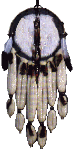
Tichanwatic, or the most human of people, are better known by their Waco name, Tonkawa, meaning they all stay together. They were one of the historic inhabitants of Central Texas when Europeans first ventured into the region. Before European expansion 300 years ago the Tonkawa consisted of several independent, seminomadic groups who shared a common language. These groups were the Tonkawa proper, Mayeye, Yojuane, Sana, Ervipiame, Emet, Cavas, Toho and Tohaha. Depending primarily on deer and bison, these people also ate rabbits, squirrels, skunks, rats, tortoises, fish, mussels, prickly pear tunas, pawpaws, acorns, pecans and edible roots. Rattlesnakes were considered a delicacy. In later years many of the Tonkawa served as guides for army campaigns against the Comanche. Today the Tonkawa reside in Tonkawa, Oklahoma. For more information on the Tonkawas visit www.tonkawatribe.com

Historical Points of Interest
Second Bootys Crossing
Located below the bluff on the south side of the lake near mile marker 1 on the Good Water Trail, this river crossing was once called Russell Crossing. Early settler, Frank Russell, built a rock house here in 1868. At one time, the rock house served as a postal substation where mail was distributed to area residents from saddlebags. Later, Richard Jenkins settled here and the river crossing became known as Jenkins Crossing. In more recent years, this same crossing has been called Second Bootys, implying that this is the second crossing on the North San Gabriel River above the city of Georgetown.
Crockett Gardens
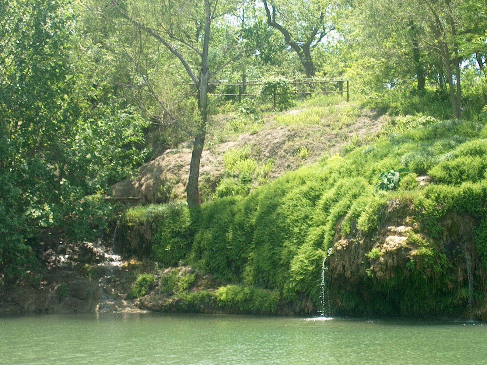
Early Anglo settlers appreciated the charm and the potential of the water and woodlands near this natural spring which is found between mile marker 2 and 3 on the south side of the lake. Before 1850, Joseph Fish owned a large tract of land along the North San Gabriel. Benjamin Gooch and John Owen bought this parcel from him and, by 1855, began operating a flour mill in this area. Twenty years later, James Knight acquired the land. In 1879, he began a truck garden and grew many vegetables including the first strawberries in Williamson County. Later R. M. Crockett, followed by the Redard brothers, would continue to operate the truck garden, selling produce in Austin. Outside Corps of Engineers' property the remains of a springhouse and corrals can be seen.
Sawyer Hollow
This hollow located between mileposts 5 and 6 of the Good Water Trail was named for William M. Sawyer, who had a farm in this area. In 1863, eight Williamson County men including Sawyer, his brother, and brother-in-law, lost their lives over a question of loyalty. The three Sawyer men joined the other five men on a trip to Mexico. Near Bandera, Texas, they were intercepted by a party of Confederate soldiers and were accused of being deserters. The men were not given a trial and were hanged. All eight men were buried together beneath a monument stating:
Remember, friends, as you pass by, As you are now, so once was I, As I as now you soon will be: Prepare for death and follow me.West End Crossing
Hayden Hunt and several of his brothers settled this area surrounding the fourth crossing upriver from Georgetown. The Hunts built a log cabin ,a gin, and a corn mill near the river crossing. They also established a family cemetery on top of the bluff near West End Crossing. Ruins of the cabin are still visible on the hill overlooking Tejas Camp across the river from mile 11 on the north side of the Good Water Trail.
Third Bootys Crossing
The concrete structure of this bridge still exists between mileposts 12 and 13 on the Good Water Trail. This was the third crossing upriver from Georgetown.
Safeguarding Our Past
The rate of archeological site destruction in Williamson County is so fast that few will survive the decade. Each of us has a responsibility to conserve our cultural heritage for future generations. We can do this by refraining from removing or damaging artifacts, historical structures and archeological sites and by reporting those who do. It is violation of law punishable by up to $250,000 to damage or destroy an archeological site or feature at Lake Georgetown. To report violations contact park rangers at 512/930-LAKE.
To learn more about the history and prehistory of Texas and Williamson County see the following websites.
Southern Texas Archeological Association: www.staa.org
Texas Archeological Society: www.txarch.org
Texas Beyond History: www.texasbeyondhistory.net
Texas Historical Commission: www.thc.state.tx.us
Three-Legged Willie -- The History and Genealogy of Williamson County: https://williamsoncountytexashistory.org/life-and-times-of-aka-three-legged-willie/
Travis County Archeological Society
P.O. Box 9464
Austin, TX 78766-9464

