Fort Worth District
Lakes and Recreation Menu
Lake Information
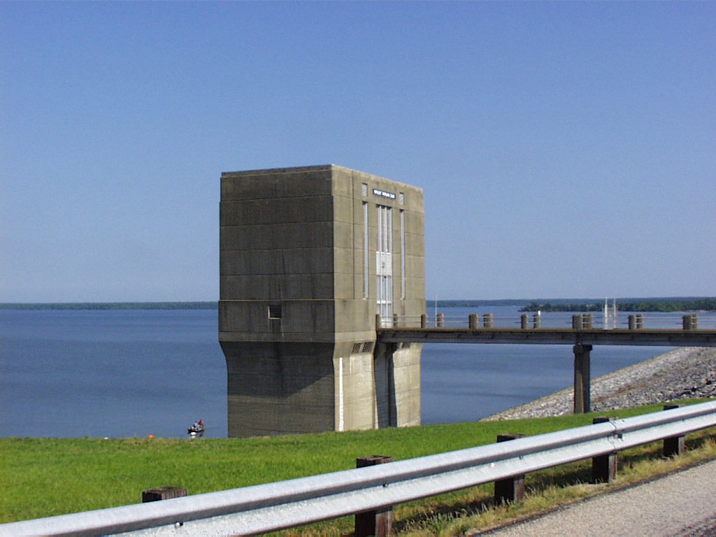
The Wright Patman Dam is designed for the retention of floodwaters from the Sulphur River basin. The Dam has a maximum height of 100 feet above the streambed, and is 18,500 feet in length (approximately 3 ½ miles). The embankment contains approximately 7,370,000 cubic yards of earth, which has been placed in layers and compacted. The crown of the dam is a public roadway. The downstream slope has been sodded with grasses to prevent erosion impacts. The upstream slope has been covered with broken stone, also known as rip rap, to protect it from wave action and erosion. The top of the dam has an elevation of 286.0 above mean sea level. The dam includes a separate outlet works and an uncontrolled spillway section. The spillway is a 200 foot uncontrolled broad crested weir structure with a crest elevation of 259.5 feet above mean sea level. Release rates from the flood control pool are made through the outlet works structure which has (two) 20 feet diameter conduits (tunnels) controlled by four 10 ft by 20 ft gates.
The Wright Patman Dam is located at river mile 44.5 on the Sulphur River about 9 miles southwest of Texarkana, Texas. The Dam is located in Bowie and Cass Counties, and the lake and Sulphur River basin extends throughout portions of Bowie, Cass, Morris, Titus, and Red River Counties. Managed fee land above conservation pool totals 58,512 acres. These lands are available for low-density recreational activities such as hunting, sightseeing, hiking, and bird watching. Management of these public lands includes resource protection, forestry management, and wildlife management. The Corps of Engineers also owns flowage easement on an additional 78,000 acres of private lands.
Wright Patman is a multi-purpose flood control lake with a conservation pool storage capacity of 145,300 acre-feet and flood control pool storage capacity of 2,509,000 acre-feet (one acre-foot is one acre of water one foot deep, or about 326,000 gallons). The Wright Patman Lake conservation pool is 220.6 feet above mean sea level and has a recreation pool of 227.5 feet above mean sea level. At conservation pool the lake covers 20,300 acres and at recreation pool the lake covers 33,750 acres. The lake has a sediment reserve of 68,000 acre-feet for storage of an estimated 100 years of sediment deposition and provides 2,363,700 acre-feet of flood control storage. It has a conservation storage of 77,300 acre-feet at the conservation pool level for municipal water supply.
Wright Patman Lake has a flood control pool, this is the portion of the lake allocated to flood control storage, located between the top of the conservation pool at elevation 227.5 msl and the top of the uncontrolled spillway at elevation 259.5 msl. The lake level at 259.5 would cover an area of 119,700 surface acres. When the lake impounds (stores) water in the flood control pool, water is released as rapidly as downstream conditions permit so that flood control storage will be available for succeeding floods. Simply put, flood control is holding back water to help prevent flood damage below the dam and releasing only as much water as the creeks and rivers will hold within their banks. The water surface level is maintained at an elevation 227.5 as much as possible; however, this is subject to fluctuation upward when flood waters are being stored, or downward depending upon evaporation and the withdrawals for water supply from the conservation storage.

